 ThingsToDo
A former railway route for a flexible country walk / SOUTHWELL
Southwell Trail
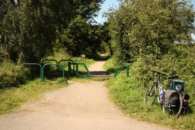
Leave the town behind on a short out-and-back along the old railway corridor. Trees and changing views give the trail a different feel from Southwell’s historic streets, and you can turn around when you have had enough. The full route reaches Bilsthorpe; there is no need to complete it to enjoy a quiet section near Southwell.

STAY NEARBY
Make a weekend of it
Find hotels and holiday rentals near Southwell Trail. Choose dates on the live map to check availability.
Affiliate link · We may earn a commission if you book.
Loading the Stay22 map allows its third-party cookies for analytics and booking attribution. Privacy details.
The full trail is 7.5 miles one way, so plan the return as carefully as the outward walk. For a town visit, choose a short section and turn back before it becomes a transport problem.
The practical details
- Where to find it
- Southwell end of the trail, Station Road area, NG25 0GL
Directions and arrival information - Tickets and booking
- There is no trail admission ticket. Check the current map and local access notices, and arrange return transport if walking a one-way section. Do not assume onward refreshments or transport will be available at your turning point.
- Access and getting around
- This is a shared route with cyclists and horse riders, with access barriers and changing surfaces. The council identifies Farnsfield as its easiest access point for all; assess the Southwell approach for your needs rather than assuming every entrance is equivalent.
Official access information - Visiting with children
- Set a modest turnaround point, carry a drink and stay aware of other route users. A short walk can work well; the whole trail is not a casual add-on after a tiring attraction visit.
Practical information checked 15 September 2026. Confirm anything essential to your visit with the venue.
Make it part of your day
Allow 1-2 hours for a short out-and-back for the visit, plus travel and breaks. This is a suggested planning allowance; opening times, access and availability may affect your plans.
Explore the Southwell guideHELP IMPROVE THIS GUIDE
Was this useful?
Tell us what helped, what is missing or what needs correcting. Your feedback goes to the editor.